Live in production

One drone flight. Your whole site in 3D.

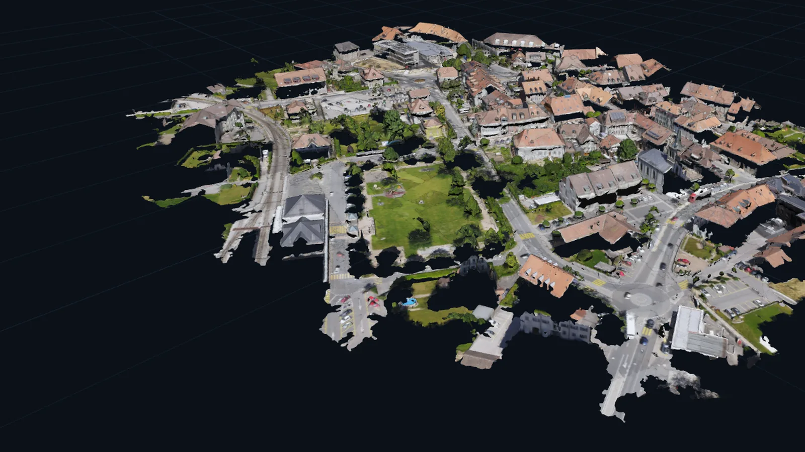
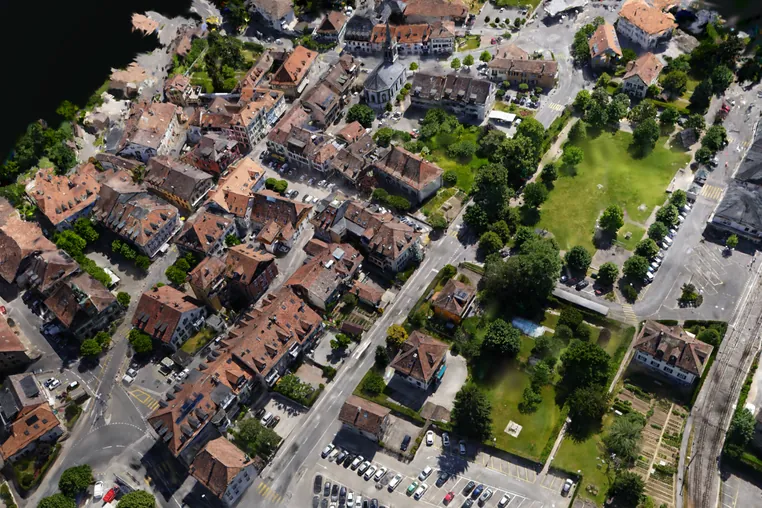
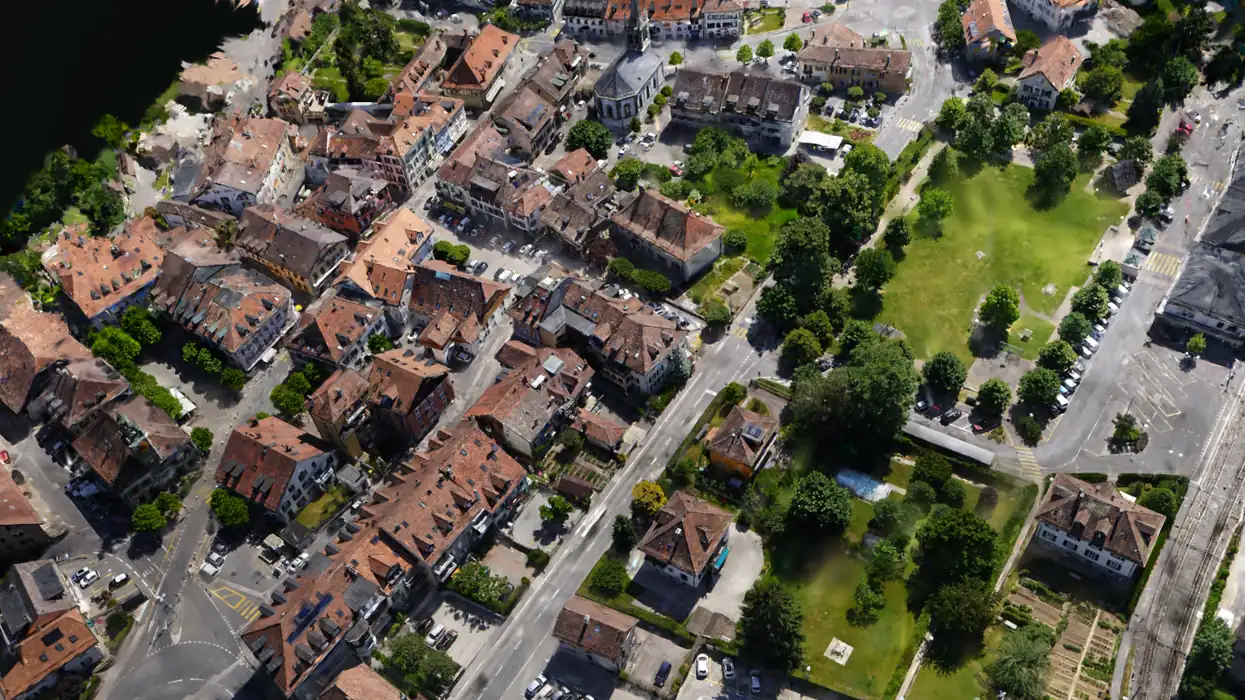
A small town rebuilt by Helios as a Gaussian splat from one drone flight, seen from above at an angle.

Turn one drone flight into a site record you can inspect, measure, share, and keep.

Upload the photographs. Everything after that happens on our machines, and the files come back to you. Built and run by Eyona Software Development in Cape Town.

Above: a Gaussian splat Helios built from one real flight. It is the same town you follow through the pipeline further down this page.

01

What you upload

The folder of overlapping photographs from one flight, dragged straight off the drone into your browser. JPEG or TIFF. Nothing to install, no GPU of your own, no desktop licence.

02

What you get back

The site rebuilt as a 3D scene you open in a browser, plus the eight files behind it: point cloud, mesh, orthomosaic, surface model, camera poses, splat, run log and a report. They are yours to keep.

03

Why it is useful

One flight becomes a dated record of the site. Take distances, areas and elevations off it, send a link to a client with no login, and fly it again next month to see what changed.

02 The transformation

Photographs go in. A scene comes out.

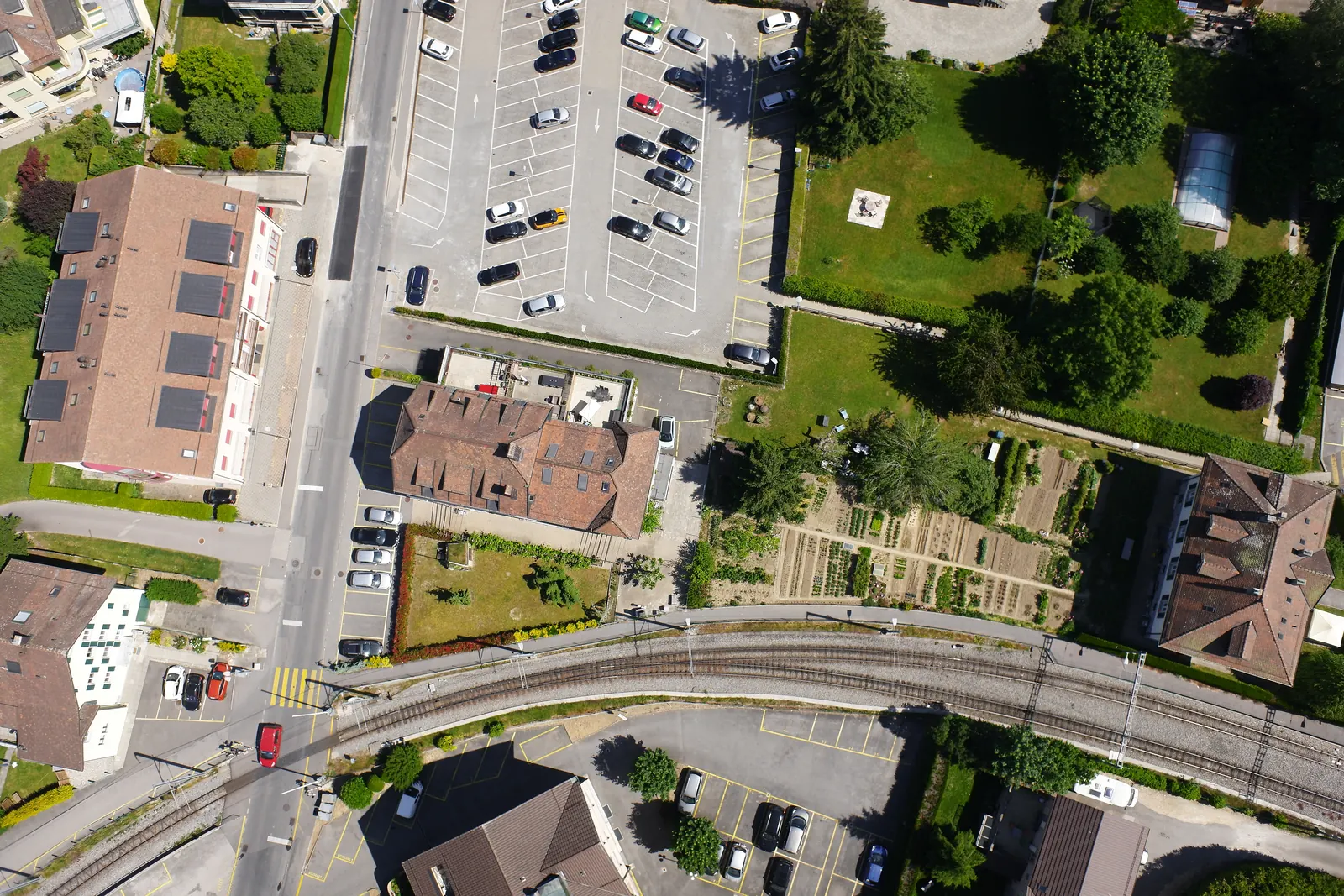
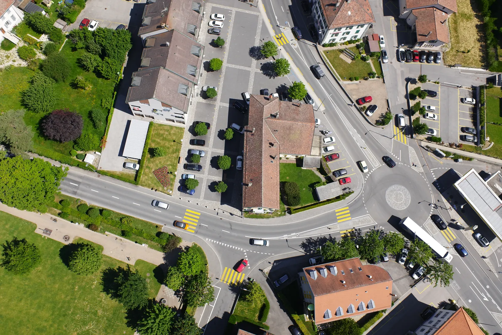
You hand over a folder from one flight. Everything below happens on our machines. Scroll to watch one real site move through the steps.

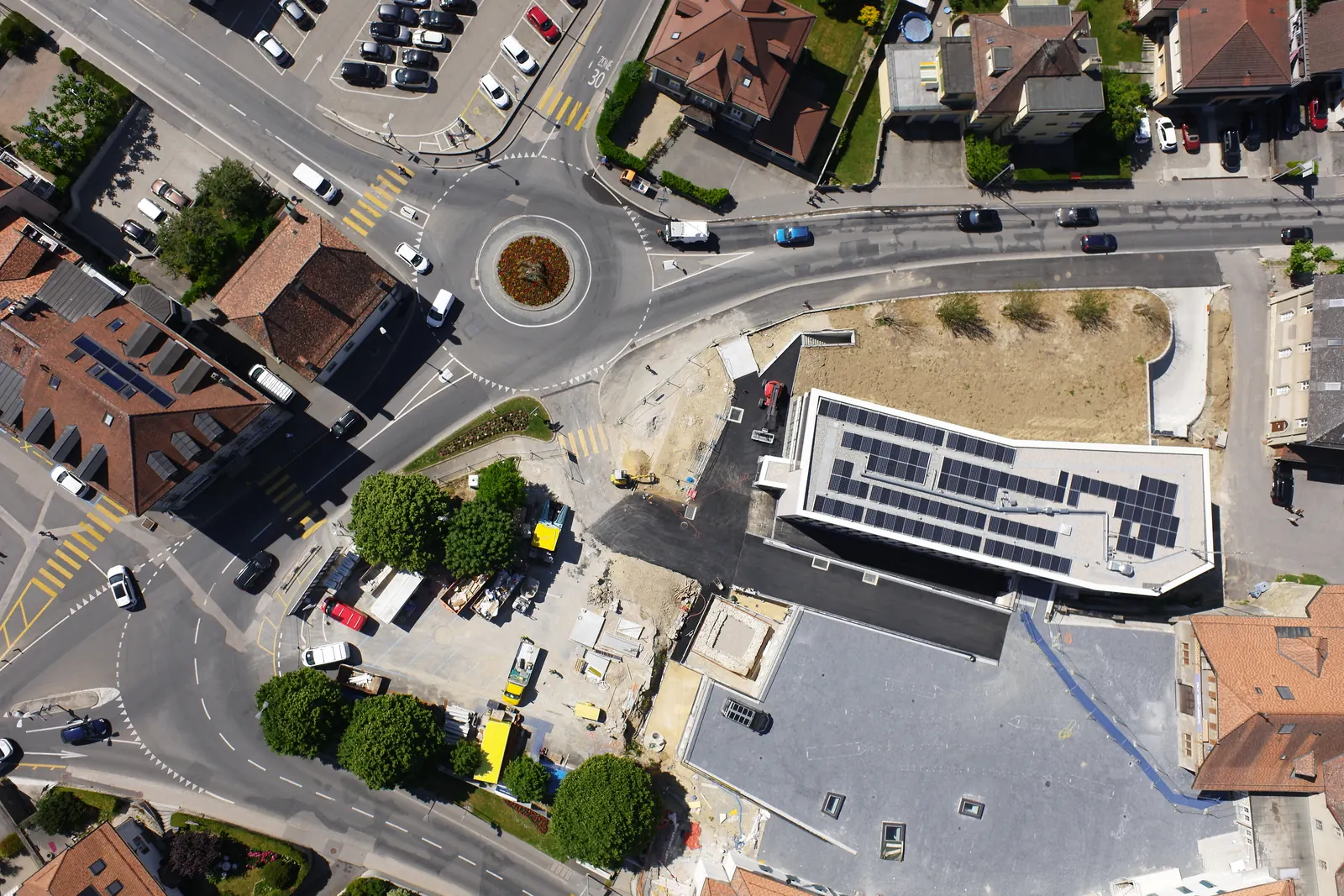
One frame from the flight, looking straight down on a town crossroads, roofs and trees.
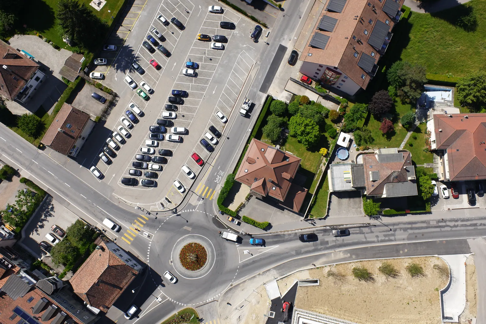
A second overlapping frame from the same flight, over a roundabout.
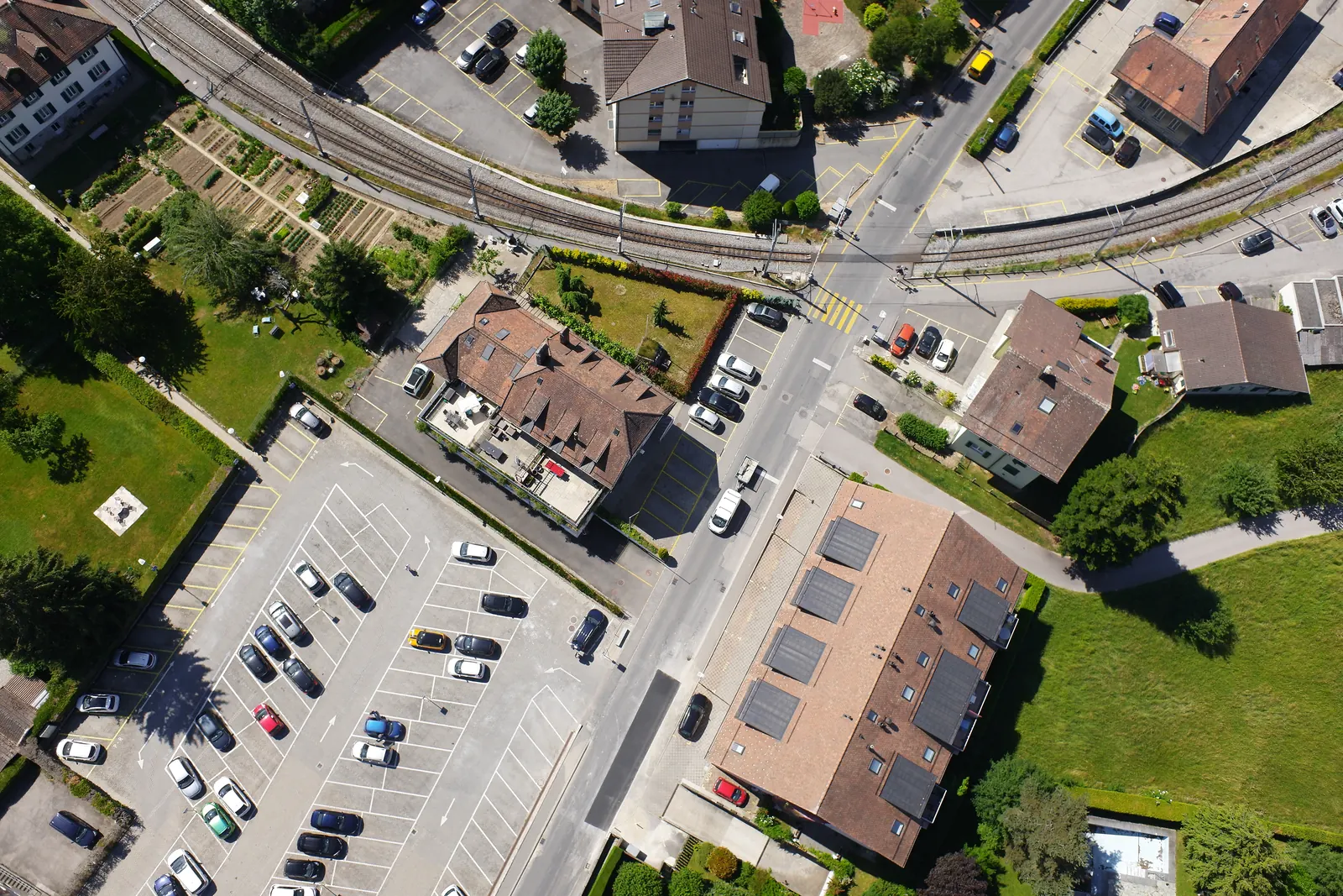
A third overlapping frame from the same flight, over a car park and houses.
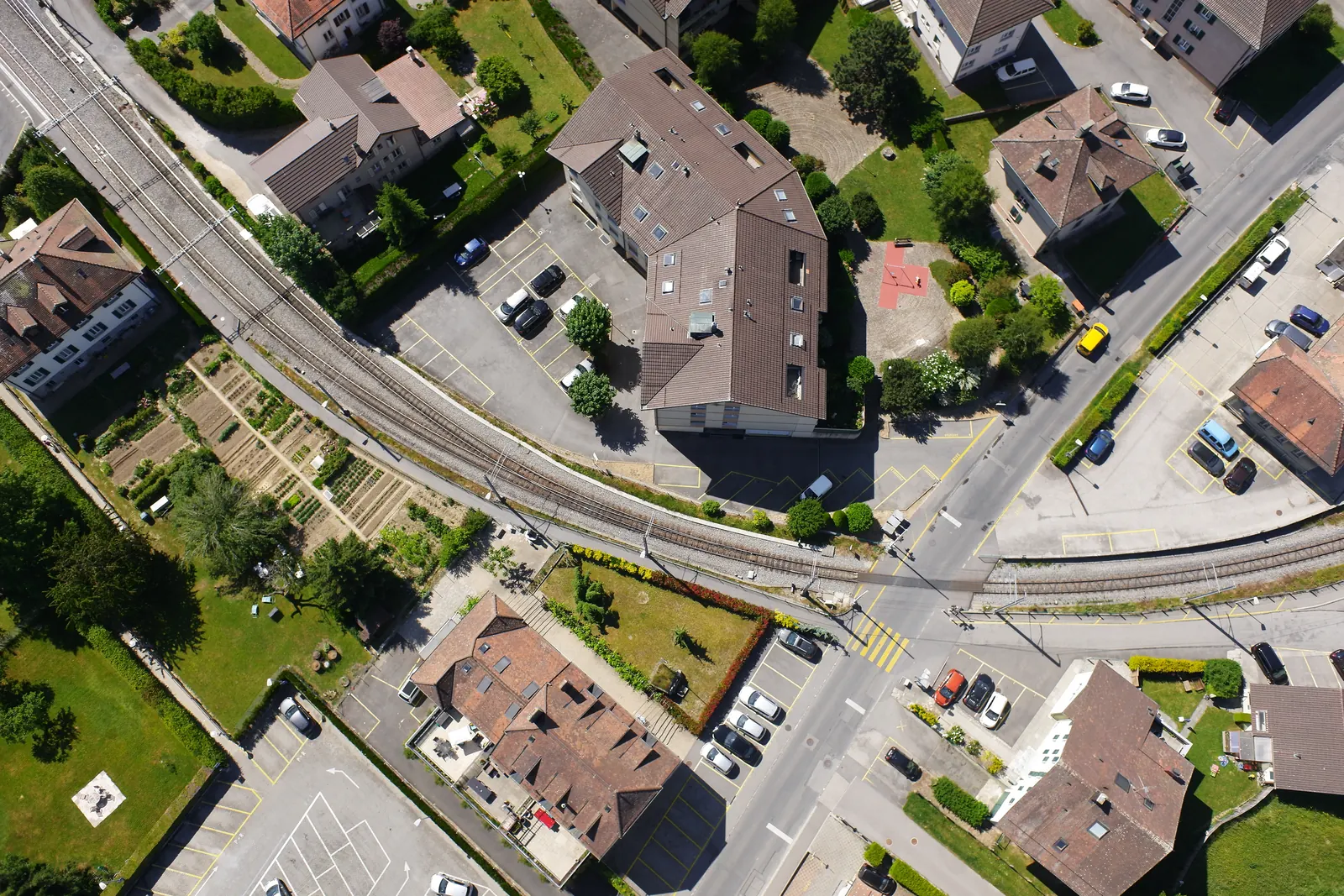
A fourth overlapping frame from the same flight, along the railway line.
A fifth overlapping frame from the same flight, further along the railway.
A sixth overlapping frame from the next flight line, over gardens and a car park.
A seventh overlapping frame from the same flight, over a street corner.

Step 01

Overlapping photographs

Hundreds of frames from one flight, each one overlapping the next. On their own they are just pictures of a place. These seven are real frames from a 100 photograph flight over a town, the same flight the next three steps were built from.

JPEG or TIFF, straight off the drone

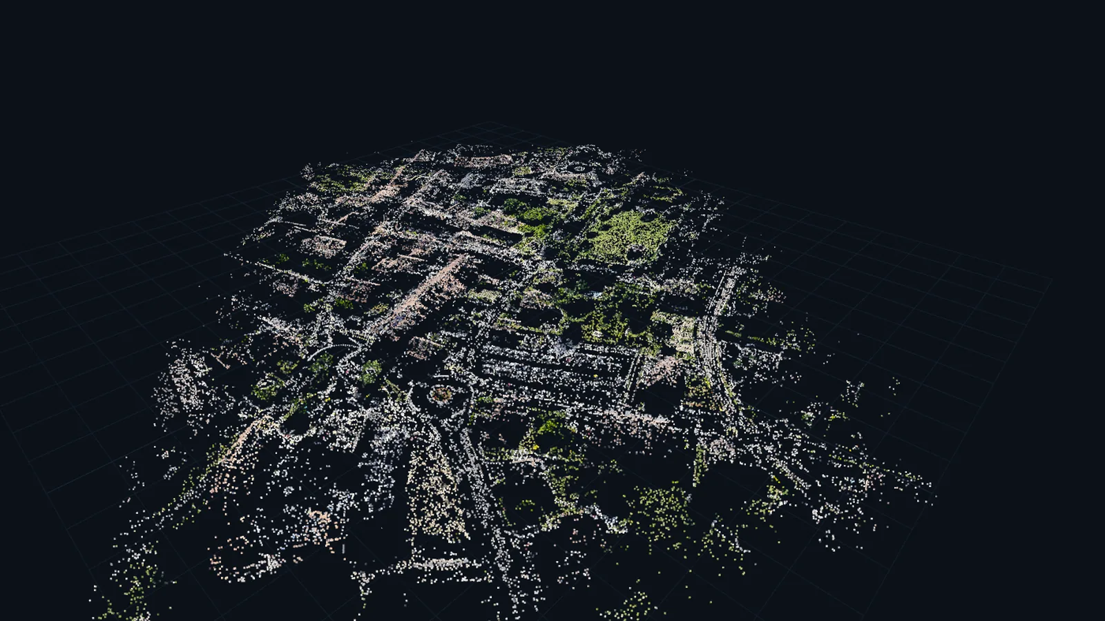
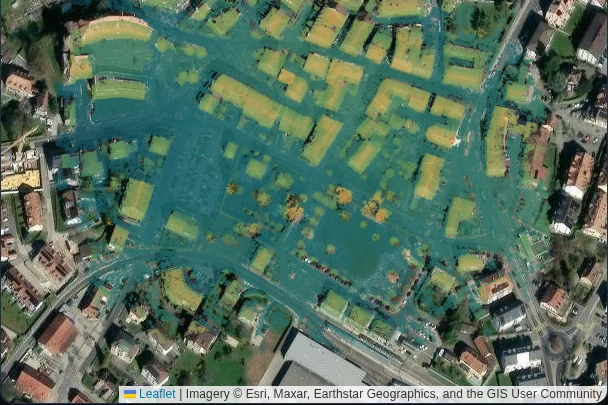
A thin sparse point cloud of the town, placed while the camera positions were solved.

Step 02

Solved camera positions

The pipeline works out where every camera stood and where it was pointing, from the pictures alone, and places a thin layer of points wherever the views agree. On this flight all 100 photographs were solved.

Camera poses, COLMAP format

The same town as a dense cloud of discrete coloured points.

Step 03

Dense point cloud

Matching the same detail across many frames turns into millions of 3D points. Look closely and the trees and roofs are still grains rather than surfaces. This is the first output in the run you can measure on.

Point cloud, PLY or LAZ

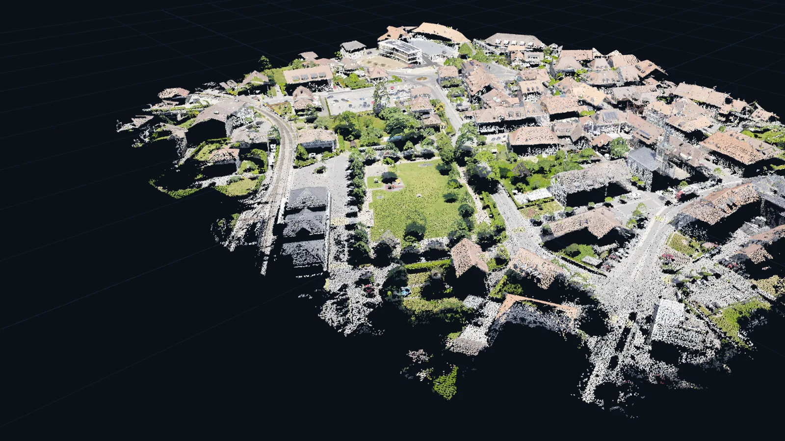
The same town again as continuous geometry with the photographs wrapped onto it.

Step 04

Textured mesh

The points become a continuous surface with the photographs wrapped onto it. Roofs and walls read as solid surfaces instead of grains. This is what goes into CAD, a viewer or a game engine.

Mesh, OBJ or GLB or PLY

Steps 02 to 04 are real captures from the Helios viewer of that same flight, steps 03 and 04 from one fixed camera position so they line up. Nothing there is one picture with a filter over it. The Gaussian splat runs as its own lane on the same upload and lands in the same results, listed in the outputs below.

03 What comes out

Eight files, in standard formats.

One flight produces one job, and one job produces every file below. Work in the browser viewers and download nothing, or take the lot. They open in the tools you already run, and nothing is locked inside a viewer you pay for next year.

Delivered per job
OutputFormatWhat it is forMeasurable
Dense point cloud PLY / LAZ Millions of 3D points. Distances, areas and volumes are taken on this. ✓
Textured mesh OBJ / GLB / PLY A continuous surface with the photographs on it, for measurement, CAD and viewers. ✓
Orthomosaic GeoTIFF The whole site flattened into one straight down image, ready to drop into a GIS. ✓
Digital surface model GeoTIFF Height at every pixel. Contours, slopes, cut and fill. ✓
Gaussian splat PLY / KSPLAT The scene you fly through in a browser. Photoreal, and never measurable. no
Camera poses COLMAP Where every photograph was taken from. Reprocess in your own tools whenever you want. -
Run log JSON Every stage the pipeline ran, its timing and its settings. -
Report PDF The run, the numbers and the accuracy statement in one document you can hand over. -

Measurable means you can take readings on that output, in our viewers or in your own software. Scale is relative unless ground control is used. Georeferenced outputs carry a real coordinate system, taken from the flight's own coordinates and written into the file.

04 How it works

From upload to delivered files.

No desktop software, no queue you cannot see. Every screen below is the running product, captured from the live platform.

  1. 01

    Open it and see where every flight stands

    The dashboard is the whole organisation on one screen: what is running right now, how many results have been delivered, and the median turnaround measured across those runs rather than estimated. Every figure on it is read from our own flights.

    Live status, measured numbers
  2. 02

    Create a site, then file every flight against it

    A site is a place you fly. Every inspection you run there stays filed against it, so a year of flights sits in one list with its state, its outputs and the day it last moved.

    Sites, inspections, results
  3. 03

    Upload the flight

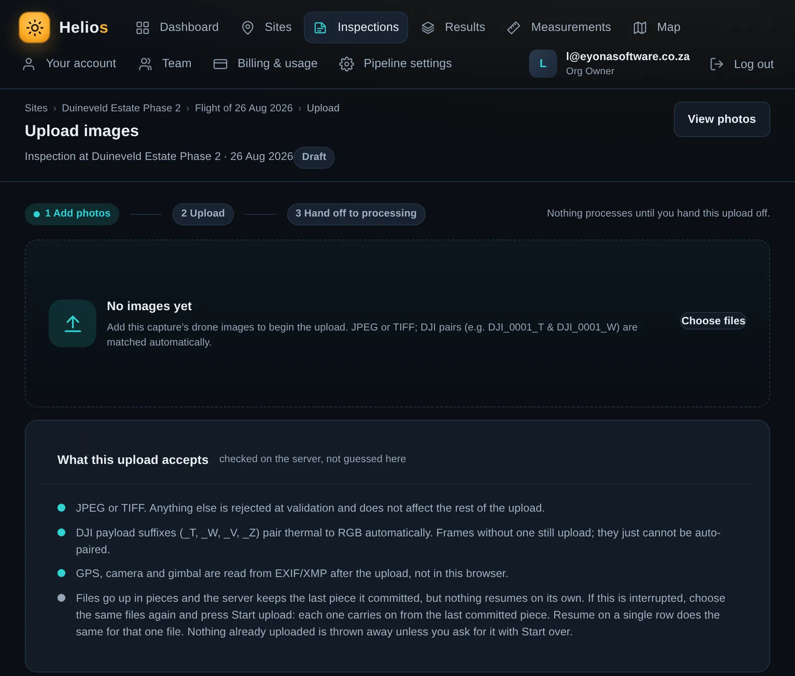
    Drag the folder straight off the drone into the browser. The server checks each file rather than guessing in the page, and DJI payload pairs, the _T and _W frames, are matched automatically. Nothing processes until you hand the upload off.

    JPEG or TIFF, resumable
    Helios / upload
    The Helios upload screen with its three step header and the drop area for drone images.
  4. 04

    Choose what comes out

    Photoreal or measurable. What you pick decides what the pipeline builds and what lands in your results. Nothing is queued until you decide.

    Photoreal / Measurable
  5. 05

    See the price before anything runs

    The quote is fixed and it appears before a single photograph is processed. Accept it and the run starts. Ignore it and nothing happens, and nothing is charged.

    Nothing processes until you accept
  6. 06

    Watch it run

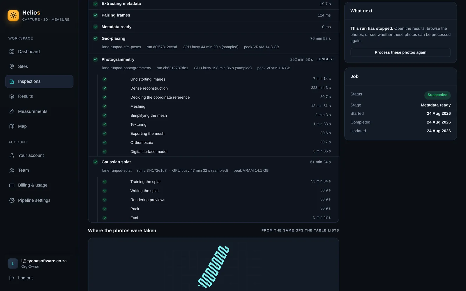
    Every stage reports live while the pipeline works, with its own timing and its own result. Median turnaround measured at about 2.6 hours across our runs. Bigger flights take longer, and they say so: the run below spent 252 minutes in photogrammetry alone, and the screen never leaves you guessing.

    Live stage progress
    Helios / processing
    The Helios processing screen with completed pipeline stages, their timings and a succeeded job status.
  7. 07

    Open the results

    The finished scene opens in the same browser, in the viewers below. The files are yours to download and keep, and a share link puts them in front of your client without an account.

    See the viewers below

05 In your browser

It opens in a browser. Nothing to install.

One 3D viewer for the mesh, the point cloud and the splat, and a map view for the orthomosaic and the surface model. Measurement lives inside the viewers.

01

Measure in the viewer

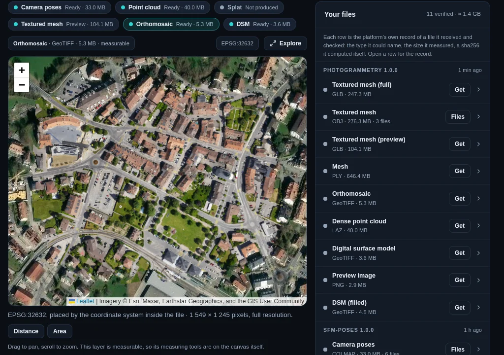
Open an output, then take distances, areas and elevations on it and save them with the job. Every row on the right is the platform's own record of a file it produced and checked: the type, the size it measured, and a checksum it computed itself.

Results screen
Helios / results
The Helios results screen with the town's orthomosaic on a satellite basemap, the measuring tools and the delivered file manifest beside it.
02

Every site on one map

The orthomosaic and the surface model sit at the site's own coordinates on a satellite basemap, so a person who was never on site can find the job before they open it.

Map view
Helios / surface model on the map
The town's digital surface model, shaded by height, laid over a satellite basemap at its own coordinates.
03

One link for your client

A share link opens the outputs, the numbers and the accuracy statement in any browser. No login, no account to create, and you choose how long it lives.

Expires after 7, 30 or 90 days

06 Measured, not promised

We publish the number and what it is not.

We have no logo wall to show you, so here is a measurement instead. Thirty two camera views were held out of training, the finished model was asked to render those exact viewpoints, and each render was compared to the photograph it had never seen.

25.389 dB mean PSNR across 32 held out views
Helios, production pipeline25.389 dB
Published 3DGS reference, same scene24.25 dB

From our own run of the town flight on this page, separately: 100 of 100 camera positions solved, 6,178,028 points in the dense cloud and 4,295,215 gaussians in the finished splat.

Held out checkMeasured
Views held out
32
Mean PSNR
25.389 dB
Lowest view
21.594 dB
Highest view
27.341 dB
Published 3DGS reference
24.25 dB

Scene: Truck, from the public Tanks and Temples benchmark, run through our production splat pipeline at 30,000 iterations. Reference: Kerbl et al. 2023, same scene.

What this number is notPSNR is image fidelity, how close a render sits to the photograph. It is not a survey accuracy, and nothing on a splat is measurable. Measurements are taken on the mesh or on the point cloud.

What the scene is notTruck is a ground level public benchmark scene, not one of our aerial jobs. It shows our pipeline is sound against a published reference on identical input. It does not predict what any one site will score.

07 A finished scene

The same site, turned three ways.

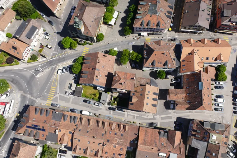
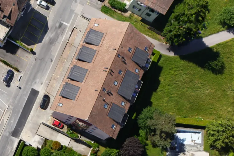
The splat at the top of this page is a small town, built from one flight of 100 photographs. Below are three pictures Helios rendered from that same splat: the whole scene, then straight down, then in close on one roof. One flight, three camera positions.

A Gaussian splat of the town seen from above at an angle, the whole scene in one frame.
Helios / splat render · the whole scenerendered from the finished splat
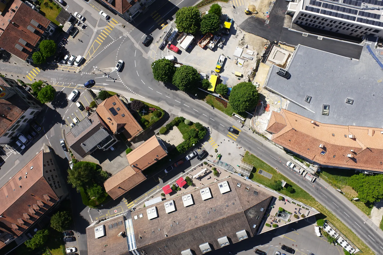
The same splat looking straight down on the old town centre, with tiled roofs, streets and pedestrian crossings.
Helios / splat render · straight down
A closer view from the same splat: a roof with solar panels, the street beside it and a garden.
Helios / splat render · in close

You turn, zoom and pan this yourself in the browser, and a share link puts the same scene in front of a client with no login. A splat is a picture of the site, so nothing on it is measurable: distances, areas and volumes come off the mesh or the point cloud from the same job.

08 What it costs

Pay for the photos you fly.

R140 a run plus 70c a photo (200 compute plus 1 a photo). 300 photos is R350.

That buys the measurable 3D model, the map and the measurements: point cloud, textured mesh, orthomosaic and surface model, online to view, share and download. You pay only when the files are delivered. A failed run is free.

Plus a free 3D fly-through on smaller flights, up to about 650 MB of photos, roughly 100 from a 20 megapixel drone.

  • Fixed quote firstOn screen before a single photo is processed.
  • Charged on deliveryNot on upload, not on the attempt.
  • A failed run is freeIf it does not deliver, you pay nothing.
  • First month onlineIncluded in the run price.

What a flight costs

Price per run, in rand, Standard detail
Photos in the flightPrice
20R154220 compute
100R210300 compute
300R350500 compute
1,000R8401,200 compute
3,000R2,2403,200 compute
More than 3,000We quote it

The app counts credit in compute: 1 compute = R0.70, so 300 photos is 500 compute.

Every flight gets the same measurable model, map and measurements. Above 3,000 photos we price the job by hand before anything runs.

photos

Type the number of photos in your flight.

StandardOur default
-
DetailedFiner edges and thin parts
-
Full sizeEvery pixel of your photos
-

Detailed is 2 and Full size 3 compute a photo (R1.40 and R2.10), on the same 200 compute a run. Your quote in the app uses the same prices.

Fly every week?

Field is R1,500 a month for R1,800 of credit (2,571 compute), about 5 runs of 300 photos. Pro is R4,500 a month for R7,000 of credit (10,000 compute), about 20 runs of 300 photos. More runs for the money. Optional, and nothing renews by itself.

Is the 3D fly-through included?

On smaller flights, yes: up to about 650 MB of photos, roughly 100 from a 20 megapixel drone, the Gaussian splat comes free with the run. Bigger flights get the full measurable set without it for now.

Can I have it faster?

Yes. Rush adds 50 percent for a dedicated processing lane and the fastest turnaround. It is optional and shown on the quote before you accept.

Can I get only the fly-through?

Yes, from R149 on the same smaller flights. It is a picture of the site with no measurements, so nothing on it can be measured.

What does it cost to keep a site online?

Each run includes its first month online. After that every account keeps 10 GB free (Field 100 GB, Pro 500 GB), and more space comes in packs from R149 a month for 50 GB up to R1,699 for 1 TB.

Is there a fair-use limit?

Viewing through share links and downloads are included within fair use. If your files outgrow your space nothing is deleted; new uploads wait until you pick a bigger pack or delete files.

Can I pay with a card from outside South Africa?

Yes. You top up credit by card through PayFast, which charges in rand, and your bank converts it.

Create an account and price your own flight. The quote is on screen before anything runs, and nothing is charged until the files are delivered.

09 Who it is for

Anyone who has to prove what a site looked like.

10 The honest part

What Helios does not claim.

  • 01
    Scale is relative unless ground control is used. Without control points the reconstruction is proportionally right, but it is not tied to real world units and the sizes are unproven.
  • 02
    A Gaussian splat is a picture of the scene, not a surface. Nothing on a splat is measurable. Measure on the mesh or on the point cloud, the outputs with real geometry behind them.
  • 03
    There is no AI enhancement anywhere in the pipeline. Ask us which pixels the camera saw and which pixels a model imagined, and the answer is none of them. Every output is reconstructed from your photographs and nothing else.
  • 04
    PSNR is a similarity figure between a render and a photograph. It is not an accuracy figure and we will not present it as one.

If a job needs proven accuracy, say so before you fly. We will tell you what that takes, or we will tell you we are not the right fit for it.

11 Questions

Asked before you ask.

What is Helios?

Helios is a drone photogrammetry service by Eyona Software Development (Pty) Ltd of Cape Town, South Africa. You fly your own site with your own drone, upload the overlapping photographs in a web browser, and Helios rebuilds the site in 3D on our machines and returns the files: a dense point cloud, a textured mesh, an orthomosaic, a digital surface model and more, in standard formats that are yours to keep.

What do I get back after a run?

The dense point cloud, the textured mesh, the orthomosaic, the digital surface model, the camera poses, the run log and a PDF report, plus the Gaussian splat on smaller flights. They are yours to download and keep.

How long does a job take?

Median turnaround measured at about 2.6 hours across our runs, and you watch every stage report live while it works. A large flight can run considerably longer, and the progress screen names the stage it is on and how long that stage has taken.

What does it cost?

A measurable run is R140 plus 70c a photograph at Standard detail (200 compute plus 1 a photograph), so 300 photographs cost R350 (500 compute) and 1,000 cost R840 (1,200 compute). Detailed and Full size cost more per photograph and rush adds 50 percent, all shown on the quote. The quote is fixed before anything runs, you are charged on delivery only and a failed run costs nothing. Above 3,000 photographs we prepare a custom quote.

Is there a monthly cost?

Only if you keep more online than your account includes. Every delivered run is a live site you can view, share and download, and its first month online is included in the run price. After that, every account includes 10 GB (Field 100 GB, Pro 500 GB), and more space comes in storage packs from R149 a month for 50 GB up to R1,699 for 1 TB. Field at R1,500 a month and Pro at R4,500 a month are optional plans that give you more credit than you pay for. Nothing renews by itself.

How do I pay?

Create an account, which is free and needs no card, then top up credit in the app by card through PayFast. All prices are in South African rand, and cards from outside South Africa pay in rand too.

Can I measure on the outputs?

Yes, inside the viewers: distance, area and elevation on the orthomosaic and the surface model, point to point on the mesh, and measurements can be saved with the job. Never on the splat, which is a picture and not a surface.

Does my client need an account?

No. A share link opens the outputs, the numbers and the accuracy statement in any browser, with no login. You choose whether the link lives for 7, 30 or 90 days.

What photographs does it accept?

JPEG or TIFF from a single flight, uploaded in the browser and resumable if the connection drops. DJI payload pairs, the _T and _W frames, are matched automatically. The app prices flights of up to 3,000 photographs on screen and we quote bigger ones by hand; the free fly-through fits up to about 650 MB of photos.

Is anything AI generated or enhanced?

No. There is no AI enhancement anywhere in the pipeline. Every pixel in every output is reconstructed from the photographs you uploaded, and nothing is imagined by a model.
12 Next

Price your own flight in a few minutes.

Create an account, upload the photographs and the fixed quote is on screen before anything runs. An account is free and needs no card.

Where it stands

Helios is live in production and running real flights today, at portal.helios3d.co.za. The pipeline, the viewers, the map and the billing run are all in service.

What is still moving

Solar panel inspection is a later module and has not shipped yet. Flights above 3,000 photographs are quoted by us before anything runs.

Helios runs at portal.helios3d.co.za